Every large project, whether it ends up as a quiet residential community, a logistics hub on the outskirts of a metro, or a multi-acre industrial park, starts long before the first excavator arrives.
It begins with something far less visible but far more decisive—a land development plan.
Both in the U.S. and India, rapid expansion has shown one truth repeatedly—when planning is weak or rushed, delays multiply, budgets inflate, and environmental conflicts emerge at the worst possible time.
In this blog, we will explore why detailed land planning has become the most important early-stage investment in land development, how modern tools are reshaping the planning process, and how firms like MMCPL help transform an empty parcel into a workable, compliant, and future-ready blueprint for living and working.
What Is a Land Development Plan and Why Does It Matter?
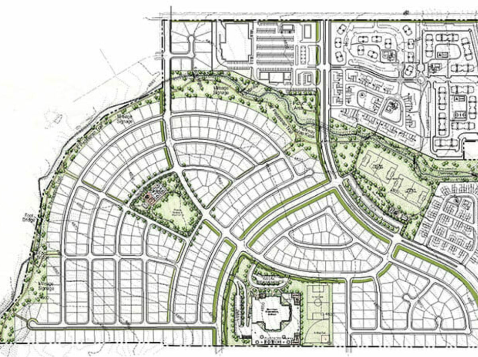
A land development plan is essentially the master roadmap for how a parcel of land will evolve from raw terrain to a functioning residential block, industrial estate, commercial district, or mixed-use zone.
It also makes sure that zoning regulations, engineering feasibility, environmental considerations, utility networks, and long-term growth are in alignment.
In practical terms, a good plan accounts for everything—road geometry, drainage paths, power corridors, water infrastructure, stormwater detention, soil conditions, easements, environmental buffers, public space, and land-use zoning. Without this foundation, the rest of the project becomes guesswork.
Take the land development process in the U.S., for example. Most subdivisions in states like Texas or Florida must match local master plans before permits even enter review.
In India, industrial estates in Maharashtra or Gujarat follow similar logic. Plots only move to construction when the land development plan checks out technically and regulatorily.
And when done right, a detailed project report ensures a project is financially viable, buildable, environmentally sound, and backed by all approvals.
But how is this land development plan made? What are the foundational components that go into foolproof planning and execution?
The Core Pillars of a Successful Land Development Plan

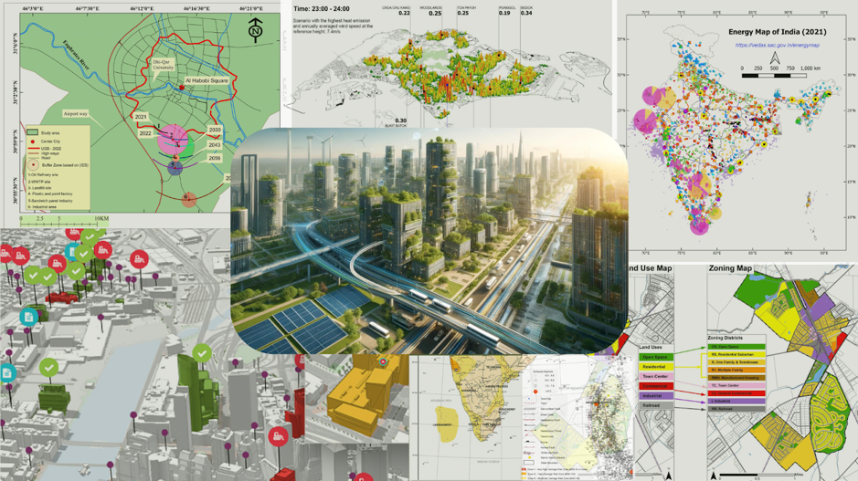
Image source: https://amsindia.co.in/sustainable-urban-development-shaping-greener-indian-cities/
There are many components that determine whether a development progresses smoothly or hits friction early. And each of these factors plays a different role, but together they determine the quality of the final plan.
-
Site Analysis and Feasibility
Before any design begins, planners study soil quality, topography, hydrology, flood zones, seismic data, and environmental sensitivities.
A slight slope or a hidden water table can completely change road alignment or building foundations. This is where many projects either strengthen or fail silently.
-
Zoning and Regulatory Compliance
Every local government, whether a U.S. county or an Indian municipal corporation, has its own planning code.
A land development plan must match these rules or seek variances, which can take months. A mismatch here often becomes the biggest cause of delays.
-
Infrastructure Design
Roads and motorways, drainage networks, water lines, sewer systems, power corridors, broadband ducts, and fire infrastructure also must be coordinated.
This is where integrated engineering and innovation matters—civil, traffic, utility, and environmental teams must plan as one. When done right, detailed designs can change how you approach the project.
-
Environmental and Social Integration
This includes runoff management, sediment control, green buffers, noise limitations, and open spaces.
Many U.S. and Indian cities now require sustainability scoring or environmental sensitivity and impact checks before layout approval.
-
Financial and Risk Planning
Sometimes, a project may be technically brilliant but financially weak. And that’s why budget allocation, phasing, cash flow timing, and contingency buffers are essential to ensure the development remains feasible even when costs fluctuate.
A well-prepared land development plan doesn’t just speed up approval, but it also prevents redesigns, cost escalations, and disputes during construction.
How a Smart Land Development Plan Shapes Modern Infrastructure
When we say, smart land development, it goes way beyond drawing parcel boundaries. Today, technology has fundamentally reshaped how planners plot and use land, predict future challenges, and align infrastructure with modern urban life.
Here are some of the most prominent technologies that are shaping land development and modern infrastructure:
GIS and Digital Mapping:
High-accuracy GIS layers help planners analyze slope, water flow, underground utilities, wetlands, and environmental boundaries. GIS also reduces land wastage and helps align infrastructure with natural terrain, not against it.
3D Modeling and BIM:
With BIM models, planners can visualize road elevations, drainage gradients, and utility crossings long before construction. Conflicts that previously used to happen mid-construction are now resolved at the planning table.
AI-Based Forecasting:
Many U.S. states already use AI tools for forecasting stormwater behavior, traffic loads, or utility demand. Instead of designing for the present, AI helps plan for a 10–30-year horizon.
Collaborative Multi-Disciplinary Planning:
A land development plan is no longer made by one engineer. It’s a shared effort involving architects, civil engineers, environmental experts, transport planners, hydrologists, and regulatory teams.
Remember, technology may improve accuracy, but the real difference still comes from alignment—bringing all expertise to the table early so decisions remain cohesive, not fragmented.
The Consequences of Not Having a Land Development Plan
If you ignore land development planning in the early stage of development, your project may fail due to many reasons—such as:
- Inadequate drainage planning leading to waterlogging or localized flooding
- Zoning non-compliance that forces redesigns or permit rejections
- Incorrect cost estimation that triggers funding challenges mid-project
- Fragmented coordination between surveyors, engineers, and regulators
- Environmental clearance delays due to missing documentation
Across many regions, from U.S. suburban expansions to India’s peri-urban industrial belts, cost overruns, delays, and legal conflicts often stem from foundational planning mistakes.
In land development, every oversight in planning eventually multiplies itself during construction. And once concrete is poured, correcting a planning error becomes ten times more expensive.
The Future of Land Development Planning

The link between infrastructure and economic development is only getting stronger in the modern world. No surprise then, that land development is entering a new phase where sustainability, resilience, and data intelligence guide decisions.
Climate-aware planning is also the norm. Developers now factor storm intensity, heat zones, groundwater recharge, and long-term resilience from day one.
Moreover, integrated digital ecosystems are emerging, where surveyors, civil engineers, GIS analysts, and government authorities review the same digital model instead of separate drawings.
Data-driven land-use optimization is being used to balance growth with ecology—something already evident in Texas’s master-planned communities and newer layouts in Pune or Hyderabad.
And that’s exactly where firms like MMCPL bring value by blending engineering, planning, environmental expertise, and digital tools to turn raw land into future-proofed, approval-ready development plans.
Plan Your Next Project with MMCPL
There’s no doubt that a well-thought-out land development plan doesn’t just cut project risk, but it also unlocks smoother approvals, better engineering decisions, and long-term financial viability.
MMCPL’s interdisciplinary planning approach combines technical engineering, environmental safeguards, digital modelling, and regulatory expertise to deliver development solutions that stand strong for decades.
If you’re planning a residential, commercial, industrial, or mixed-use project, MMCPL can help you shape land in a way that is buildable, compliant, and future-ready. Get in touch with our team today to discuss your requirements!